Coming to the end of Condatis

And at the times when I’ve not been doing burpies on the Docks in the dark (see this post), my last month has been filled with more flights than a whole forest could offset.  Mostly to get to places in the Tropics, in order to have meetings in air conditioned offices, about how to connect up landscapes for biodiversity under the influence of future climate change and habitat loss.  (I’m not sure yet how this common practice, even amongst conservation scientists, can be changed.  Thoughts welcomed!)

I’ve written a little bit about my recent trips to Ghana and Indonesia on the Condatis website.  Overall, it’s been a fascinating ten months in Liverpool for me, working on this Condatis project.  I’ve met some very great people, and learnt a huge amount from them and from my new experiences in work and play.  At the start of January, I’m migrating north, to the chilly shores of bonny Scotland (to work on PEAT!!), but hope to keep up my ties with Condatis, its great team, and the other cultures and kids I’ve gathered in Scouseland.

IMG_4619

One of the many beautiful forests I’ve visited this year, in the Heart of Borneo.


Advertisement

Time for tea in Java (Part II)

This blog post forms part two of two pieces I wrote for the Condatis News Blog, describing my recent trip to Southeast Asia as part of my role (Knowledge Exchange Assistant and Landscape Analyst) at the University of Liverpool, working under Dr. Jenny Hodgson. We spent three weeks in Malaysia and Indonesia, as a component of the 11 month NERC-funded Innovation Follow-on project: Decision support for restoring ecological networks in rapidly developing, biodiverse countries. The first blog post can be found here.

20180718_112346

The edge of the rainforest bordered by a tea plantation, within Mount Halimun Salak National Park, West Java, Indonesia.

We flew south over the forests, mountains and oil palm plantations of Borneo and landed in the recently modernised Soekarno-Hatta International Airport, retrieved Jane Hill and headed straight to Bogor, taking care to avoid Jakarta – the city of impenetrable traffic jams! We had the pleasure of staying a few minutes’ walk (and a treacherous road crossing) from Bogor’s Botanic Garden (Kebun Raya Bogor), an 87 hectare forested landscape in the middle of a city of one million residents, set up through a Dutch-British botanical collaboration in 1817. Definitely worth a visit!

The next morning we met with our main project partner for the Indonesian component of our project, Dr Lilik Budi Prasetyo, the Head of the Environmental Analysis & Spatial Modelling Lab. at Bogor Agricultural University (Institut Pertanian Bogor) and our other chief contacts, including Erlan Sodahlan, the Community Engagement Officer of Halimun Salak National Park. These two gentlemen guided us over the following three days, and were so patient in answering an almost continuous stream of questions from us interested and unacquainted British tourists!

After hearing about the exciting work that Lilik and his team are doing around improving the accuracy of remote classifying forest land cover in Indonesia, Jenny gave some background to Condatis and our collaborative project. Then it was time to head into the landscape in question: the Mount Halimun Salak National Park (Taman Nasional Gunung Halimun Salak, TNGHS).

20180716_152817

Our party stopped to view the wildlife corridor we are proposing to model using Condatis, between Mount Halimun and Mount Salak, within the National Park. (Note the road – a modern feature of most “wildlife” corridors!)

We observed a complex, fascinating landscape as we drove through, with a mix of expertly terraced rice paddy, small vegetable plots, perched hamlets on the edges of small, steep valleys, all with the backdrop of Mounts Halimun and Salak. Beautiful and interesting to look at, but far from a natural environment with only small patches of forest remaining outside of the Park. Much like all of the UK! Inside the Core Zone, there remains one of the largest continuous tracts of tropical forest in Java, and it is intact due to strict protection. Outside of this zone, there is a complex mosaic of human-modified landscapes, with degraded forest in between tea plantations, hydrothermal electricity plants and football pitches. Erlan and the National Park staff talked to us about how they are working with individual communities to develop village-specific Memorandums of Understanding on responsible use strategies and to make decisions on where to establish collaborative forest restoration projects.

IMG-20180719-WA0000

The Indonesia Condatis team outside the Taman Nasional Gunung Halimun Salak (TNGHS) Offices: Lilik, Erlan, Jenny, Jane, Pairah and me. (Photo credit: Jenny Hodgson.)

During our stay at the TNGHS Headquarters, we carried out a one-day workshop on Condatis for ten staff members of the National Park. The morning was spent introducing participants to Condatis and allowing everyone to have a go at their own analyses; the afternoon involved a discussion around the case study we are performing in their landscape. Through some lively discussions (mostly in Bahasa Indonesia!) we gathered useful feedback on the key species of interest and major conservation challenges. We are hopeful that Condatis will generate maps which will highlight priority areas for forest restoration in and around TNGHS’s corridors. We had a fascinating few days learning about another tropical forested landscape, which shares broad similarities with Sabah and important subtle differences.

Three action-packed weeks later we returned to the UK, bringing the tropical temperatures with us it seemed! Now it’s time to process all of the information we gathered on our travels across the islands of Borneo and Java, to develop our plan of work in TNGHS and to make any refinements to the Condatis layers contributing to the Sabah connectivity project. We thank everyone who made our trip so exciting, so interesting and fed us such yummy food!

Business cards, butterflies and boats in Borneo (Part I)

This blog post forms part one of two pieces I wrote for the Condatis News Blog, describing my recent trip to Southeast Asia as part of my role (Knowledge Exchange Assistant and Landscape Analyst) at the University of Liverpool, working under Dr. Jenny Hodgson. We spent three weeks in Malaysia and Indonesia, as a component of the 11 month NERC-funded Innovation Follow-on project: Decision support for restoring ecological networks in rapidly developing, biodiverse countries.

IMG_4723

The kind residents of Kampung Sikalabaan, in Sabah’s Heart of Borneo region, showed us around their community forest and farmland for the day.

Whilst everyone was sweltering under abnormally tropical temperatures in the UK during July, Jenny and I were enjoying a relatively temperate time in the Tropics. We spent the majority of the month in Malaysia and Indonesia, visiting the partners and landscapes that are involved in our NERC-funded project: Decision support for restoring ecological networks in rapidly developing, biodiverse countries. Ghana is the other country involved in the project, which we had the privilege to visit back in April (reported on here). This time, road trip around Southeast Asia!

Our travels started with a stop-off in Kuching, Sarawak, to attend the Association of Tropical Biology and Conservation’s (ATBC) annual meeting, entitled Linking Natural History and the Conservation of Tomorrow’s Tropical Ecosystems. It was a fascinating five days, attended by a huge range of nationalities talking on a similarly wide variety of topics. Jenny presented on Condatis and I on the long-term ecology of tropical peatlands (another passion). Many of our collaborators were also there presenting, including: Professor Jane Hill and Dr Sarah Scriven from the University of York, and Dr Jed Brodie and Dr Sara Williams from the University of Montana. And we made some useful contacts for the Condatis project, as my new collection of business cards testifies.

20180711_142429 (1)

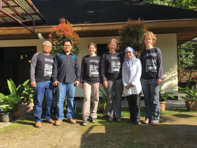
Jenny presenting the concepts of Condatis to the participants of our training workshop at Universiti Malaysia Sabah (UMS).

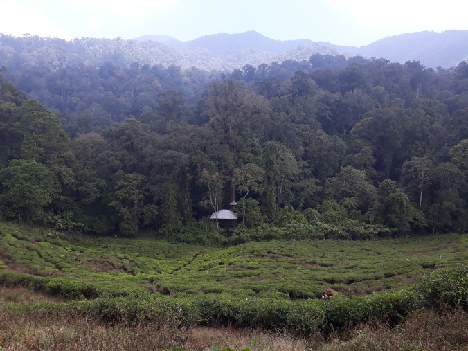
Just hours after the closing ceremony of the conference had finished (and the after party was likely still in full swing!), we flew on to Kota Kinabalu in Sabah, to attend a catch-up meeting for the Sabah-based project we are involved in. The meeting was organised by the Southeast Asian Rainforest Research Partnership (SEARRP), the charity that is coordinating this multi-stakeholder project. The other partners involved in this mapping project include the Universities of York, Aberdeen and Montana, Universiti Malaysia Sabah, the Carnegie Airborne Observatory and the PACOS Trust (an inspiring charity supporting indigenous communities in Sabah). We discussed the first set of outputs the group had developed for the project; generated using biodiversity and soils data, satellite imagery and modelling, including various layers derived through Condatis that have been incorporated into the prioritisation process. The next stage of the project will involve the PACOS Trust consulting with indigenous, forest-based communities on which of the areas highlighted through our ecological analysis, are appropriate for enhanced protection.

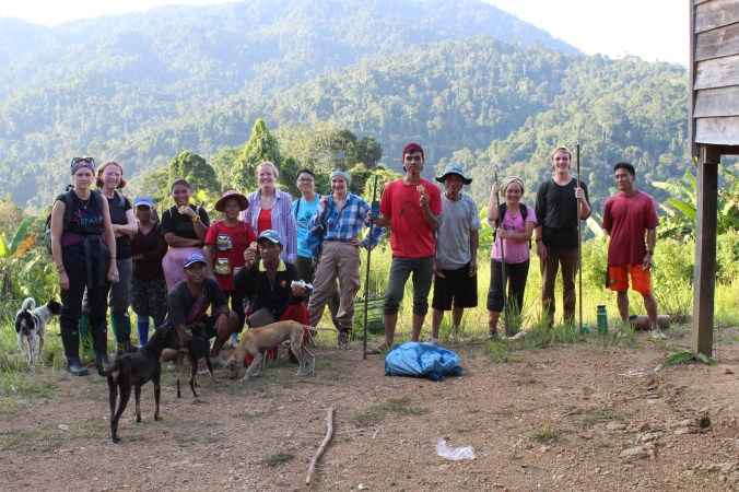
In order for us ecologists to understand the human-component of these forested landscapes, we were extremely fortunate to be invited to visit several different communities with PACOS. So the next morning, five of us, equipped with walking boots and mosquito nets, headed upstream, into the Heart of Borneo.

IMG_4486

Travelling by boat to the village (kampung) of Sikalabaan, about two hours up-river from Kampung Salong, where the road ends.

We spent three nights in the “cultural house” of Kampung Sikalabaan, along with a dozen other men and boys who were visiting in order to attend training on how to fix boat motors, organised by PACOS. These communities rely on mechanised boats to travel between villages, to school, to obtain provisions and to generate an income; with replacement parts for engines being so expensive, it is important that people know how to fix them. PACOS offers training courses for members of indigenous communities across Sabah, on subjects ranging from how to plant chilli peppers, fix broken machinery, to how to make soap, with the aim of improving their capacity to sustain a low-impact livelihood in the often remote locations they occupy.

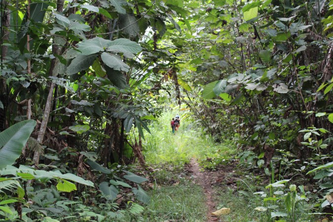
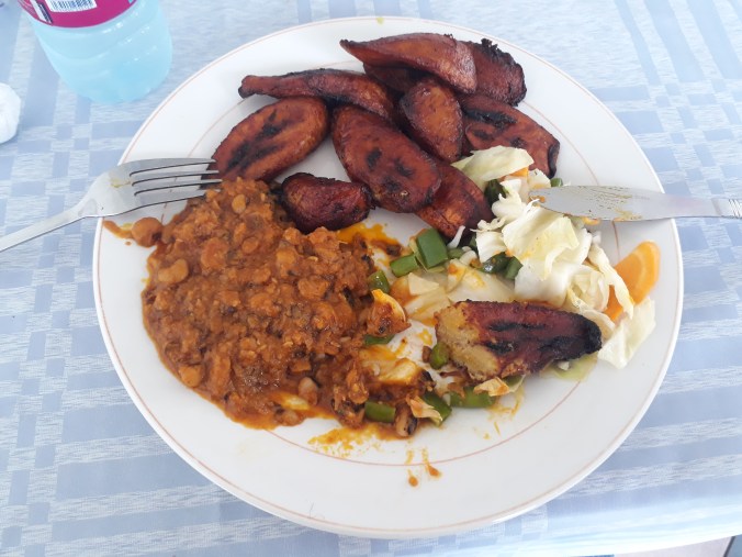
We spent one incredible day observing how members of Kampung Sikalabaan use their forest and its plethora of resources. Members of seven families led us patiently (we were significantly slower and less agile than them, despite the laden woven backpacks they were carrying!) through the jungle to their farms, laid out in forest clearings. Along the way, they stopped occasionally to harvest wild ginger or check on a small vegetable plot they’d established, apparently opportunistically, within their community land. Early afternoon, after walking upstream/in-stream for quite some time, we stopped for a spectacular picnic: out of their woven baskets, the women produced a feast for the twenty or so of us, with freshly boiled rice, freshly picked aubergine broth and then to top it off, they caught and we cooked freshly-netted fish from the flowing waters two feet away. Beats a Sainsbury’s sandwich.

It was a privilege to see how this community so expertly uses their land, and how important it is for them to have access to the forest and its resources. With rural-urban migration and the designation of ‘communal lands’ providing opportunities for the expansion of oil palm into these areas, as well as pressures on resources and disturbance to ecosystems from logging, industrial agriculture and mining, these community-owned lands are being compromised. The Government’s goal of expanding strictly protected areas across more of its forested asset adds another dimension to the challenge of maintaining indigenous communities in these landscapes. But more discussion on this complex issue will have to wait for a future blog! We thank PACOS and SEARRP (Gordon, Angie and Agnes in particular) for organising this insightful opportunity.

IMG_4630

The first river crossing. We didn’t realise there were about a dozen more to come. Each time it was so refreshing to wade through thigh-deep water; a welcome relief from the tropical humidity. Thankfully my camera avoided any refreshing dips though!

Leaving the forest and returning to Kota Kinabalu was a bit of a shock, though the washing machine was welcomed! The next day we headed into the Forestry Complex at the Universiti Malaysia Sabah (UMS) campus for two days of training. We had 20 participants attend from a range of backgrounds: in addition to UMS students and lecturers, people attended from the Departments of Agriculture, Irrigation and Drainage (JPS), Forestry (SFD) and Environment Protection (JPAS), from WWF-Malaysia and SEARRP. The first day was led by Dr Sarah Scriven and introduced participants to the R program and how to perform basic analysis and geospatial data processing. The second day, led by myself and Jenny, introduced the concept of Condatis, followed by an interactive session where we guided people through performing their own analyses using the new web version of the tool. (Butterflies (rama-rama in Malay) were used as the study organism; Jenny’s favourite!) Though we were a little optimistic as to how much material we wanted to cover in two days, it seemed to be a success: our participants provided positive and useful feedback that we used to improve and refine our training workshop the following week in Indonesia.

With our fascinating range of meetings and field trips complete in Malaysia, we headed for the next stop-off: the island of Java.

~

For the second episode in our Southeast Asian adventure, click here or check out the next post.  

One of the things….

….I did in the 11 whole months since I last wrote anything on my poor neglected bog blog was go to Ghana.  I wrote a bit about it here, published on the website for the new project I’m Research Assistant-ing on at the University of Liveerpoowelle: Condatis.

Ghana was hugely interesting, despite the distinct lack of peat.  There were trees though, but that’s another blog post….to come (she promises!).

How Ghana does sunset.

Over this period, I’ve also surveyed 1028 fields across the country, installed two weather stations, been electrocuted two times, run 17 miles over 17 of London’s bridges, missed a marathon due to injury, applied for a handful of jobs, been invited to a couple of interviews, been convincing infront of a panel, moved to the Great North*, had a jolly send-off by my old, great crew at Rezatec**, learnt how to tune a TV to the appropriate transmission, run out of electricity, run along the Mersey, taken a ferry across the Mersey (obvs), located my nearest Waitrose (with some assistance) and am in the process of developing a Scouse accent….amongst other things.

The new project I’m fortunate enough to be a part of now, directed by Dr Jenny Hodgson and the great team she’s gathered, will take me to Indonesia, Malaysia and back to Ghana to explore how the connectivity of landscapes for wildlife can be improved with strategic habitat restoration.  You can find out more here, and hopefully in future blogs.

Peat, I’ve not forgotten you.  I’m still on the look out for pots of gold that might reunite us one day….

20180412_151011

Red-red, the food of the Ghanaian gods.

*There’s actually still a lot of north to the north of Liverpool.

**I’m ever grateful they made use of me for so long!